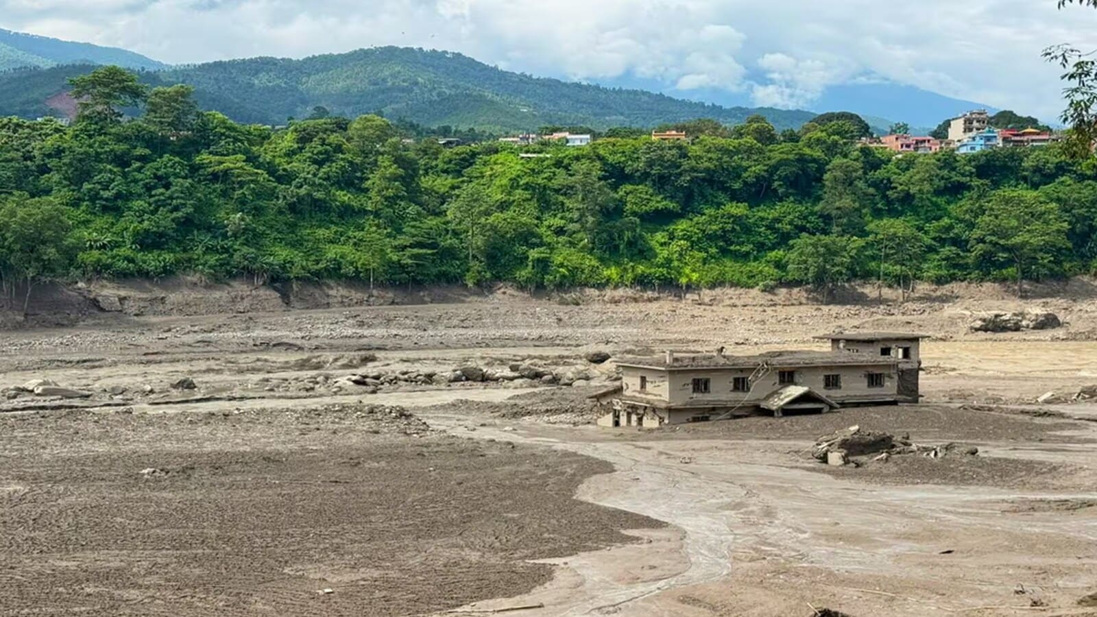
Severe monsoon weather systems and localized cloudbursts triggered catastrophic flash floods and landslides across Nepal, stranding tourists, including British nationals, and generating a rising death toll exceeding 157 fatalities. Standard journalistic coverage typically reduces such catastrophic events to isolated weather anomalies or humanitarian tragedies. This approach misses the underlying mechanics of vulnerability. To understand why a localized meteorological event transforms into a systemic disaster affecting both local populations and international travelers, the crisis must be deconstructed through operational, economic, and institutional frameworks.
The Tripartite Failure of Disaster Risk Reduction
The scale of the Nepal flash flood mortality and disruption highlights three distinct points of failure in the pre-disaster architecture.
First, early warning systems suffer from a severe spatial resolution deficit. While macro-level river basin monitoring exists, high-altitude micro-catchments where flash floods originate often lack real-time telemetry. When heavy precipitation occurs in these narrow valleys, the time lag between hydrological generation and downstream impact is measured in minutes rather than hours. This compresses the operational window for evacuation to near zero.
Second, infrastructure resilience coefficients are misaligned with shifting climate extremes. Roads, bridges, and trekking lodges throughout the Himalayan corridors are engineered based on historical hydrological baselines. These baselines assume a frequency and volume of water runoff that no longer applies under contemporary atmospheric conditions. Consequently, transport corridors fail structurally under peak discharge, cutting off ingress and egress routes simultaneously.
Third, the information asymmetry between local authorities, central government agencies, and international diplomatic missions creates coordination friction. When communication links sever during a grid outage, search and rescue deployments rely on fragmented intelligence. Rescuers operate without verified density maps of foreign nationals and domestic residents currently within the hazard zone.
The Economic and Logistical Cost Function of Remote Rescues
Executing search and rescue operations in high-altitude, rugged terrain introduces an exponential cost function governed by altitude, weather volatility, and infrastructure absence.
Total Operational Risk = (Terrain Complexity × Altitude Factor) / (Telemetry Accuracy × Access Velocity)
Helicopter extraction represents the primary intervention vector when roads wash out. However, rotary-wing aircraft face strict operational ceilings, payload limitations dictated by thin air at high elevations, and zero-visibility constraints during active monsoon squalls. When ground teams cannot deploy due to active landslide hazards and air assets are grounded by cloud cover, response times extend past the critical physiological survival window for trauma and hypothermia cases.
For international travelers, trekking without continuous satellite connectivity exacerbates this friction. Independent trekkers often bypass checkpoint registries to avoid permit fees or route restrictions. This operational opacity means emergency response coordinators must waste hours determining whether an individual is safe in an unmapped village, sheltering in place, or actively swept away in a river channel.
Systemic Vulnerability in High-Risk Tourism Corridors
The coexistence of high-volume adventure tourism and extreme geomorphological hazards demands a strict risk-transfer and safety protocol that is currently absent.
- Zoning Inadequacy: Commercial structures, including lodges and tea houses, are frequently constructed on active alluvial fans—flat areas formed by sediment deposition at the mouth of steep ravines. These locations appear stable during dry periods but serve as high-energy debris flow channels during cloudbursts.
- Communication Silos: Trekkers rely on disparate local cellular networks that fail immediately during power grid collapses, lacking mandatory fallback protocols such as decentralized satellite messengers.
- Resource Allocation: Search and rescue capabilities are reactive rather than proactive. Assets are stationed in major hubs like Kathmandu rather than decentralized tactical outposts near high-risk trekking circuits like the Annapurna or Everest regions, multiplying transit delays during the golden hours of rescue operations.
Operational Remediations for High-Altitude Catastrophes
Mitigating future loss of life among both domestic populations and international visitors requires a systemic overhaul of how high-risk zones are managed before, during, and after a meteorological shock.
Decentralized Telemetry Deployment
Governments must mandate and fund the installation of automated hydrological and meteorological sensors in high-risk, second-order tributaries rather than solely monitoring primary river trunks. Data from these sensors must feed directly into localized, automated siren networks and direct-to-device cellular broadcast systems, bypassing centralized bureaucratic bottlenecks.
Infrastructure Stress-Testing and Relocation
Engineering standards for all transit routes and permanent structures within Himalayan valleys must be recalculated using dynamic climate models rather than stationary historical data. Structures identified within high-risk alluvial fan zones require phased relocation mandates supported by international climate adaptation financing.
Mandatory Interoperable Tracking for Remote Expeditions
International trekking regulations must shift from passive permit issuance to active geofencing. Requiring all trekkers entering high-risk zones to carry lightweight, satellite-enabled check-in devices ensures that emergency services retain instantaneous location data, eliminating search ambiguity when communication lines collapse.
Resource deployment must be immediately reallocated from centralized urban bases to decentralized regional staging areas equipped with all-weather utility aircraft and autonomous supply drones capable of delivering emergency rations and medical supplies when human access is physically impossible.