The success of the Artemis II mission hinges on a shift from automated telemetry to human-integrated geological assessment. While digital sensors provide high-resolution mapping, the human eye, coupled with sophisticated optical systems, serves as the primary tool for identifying subtle stratigraphic variations and landing site viability that algorithms currently struggle to interpret in high-contrast lunar lighting. This integration of human perception into the orbital data-gathering process requires a rigorous training regimen focused on two critical domains: geomorphological pattern recognition and the physics of handheld long-range photography in a microgravity environment.
The Optical Constraints of Lunar Orbital Mechanics
Capturing usable scientific imagery from a spacecraft traveling at orbital velocities involves overcoming significant physical hurdles. The primary bottleneck is the velocity of the spacecraft relative to the lunar surface. Artemis II will utilize a high-Earth orbit and a lunar flyby, meaning the crew will experience rapid changes in angular velocity as they approach the Moon.
The optical problem is defined by the relationship between shutter speed, focal length, and the pixel-smear resulting from spacecraft motion. To maintain a ground sample distance (GSD) sufficient for scientific analysis, the crew must synchronize their physical movements with the spacecraft’s trajectory. This involves a technique known as "pitch compensation," where the photographer rotates the camera at a rate that offsets the forward motion of the Orion capsule. Failure to execute this movement with precision results in motion blur that renders the high-frequency spatial data of the lunar regolith unusable.
The Physics of Image Stabilization in Microgravity
In a terrestrial environment, photographers rely on tripods or the dampening effect of their own body mass. In the Orion capsule, the absence of weight removes the natural stabilization provided by gravity. Every movement by the astronaut—even a heartbeat or a breath—introduces vibration into the camera system. Training focuses on "soft-docking" the body against the interior structure of the spacecraft to create a human-mechanical dampener. This reduces the high-frequency jitter that internal lens stabilization systems are often unable to fully neutralize when using 400mm or 800mm telephoto lenses.
Geomorphological Intelligence and Feature Identification
The Artemis II crew is not merely taking snapshots; they are performing orbital field geology. The training involves a deep immersion in lunar stratigraphy to identify "targets of opportunity." These are features that may not be visible in satellite imagery due to specific sun angles or resolution limits.
- Impact Melt Flows: Identifying the flow patterns around craters like Tycho or Aristarchus to determine the thermal history of the impact event.
- Volcanic Vents: Distinguishing between impact-related depressions and endogenic volcanic features which indicate past internal lunar activity.
- Shadow-Zone Analysis: Using the low-angle light near the lunar poles to reveal topographical variations in Permanently Shadowed Regions (PSRs).
This requires the crew to internalize a mental map of the lunar surface. They must be able to orient themselves instantly based on "anchor points"—large, unmistakable craters or mountain ranges—and then use these to navigate to smaller, scientifically significant sites within a window of only a few minutes.
The Hardware Interface Bottleneck
The equipment used aboard Artemis II consists of modified commercial off-the-shelf (COTS) high-resolution digital cameras. However, the hardware presents a significant interface challenge. In a pressurized suit or even in standard flight suits, fine motor control is degraded.
The training protocol mandates the "blind" operation of camera controls. Crew members must adjust aperture, ISO, and shutter speed by tactile feedback alone, as their eyes must remain fixed on the viewfinder or the lunar horizon. This minimizes the time lost between identifying a feature and capturing the data. The goal is to reduce the "latency to capture," which is the time elapsed from the moment a scientific target enters the field of view until the shutter is triggered.
Lighting Dynamics and Albedo Extremes
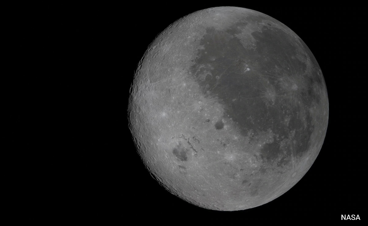
The Moon represents one of the most difficult subjects for photography due to its extreme albedo range. The lunar surface reflects very little light (roughly 7-12%), yet it exists against the absolute blackness of space. This creates a high-contrast environment that can easily overwhelm digital sensors.
Exposure Bracketing and Dynamic Range Management
The crew is trained to manage the "Histogram of the Moon." Because the lunar surface lacks an atmosphere to scatter light, there is no "fill light" in the shadows. Areas in shadow are at 0% luminance, while sunlit peaks are near 100%. To solve this, the strategy involves:
- Spot Metering: Focusing the exposure calculation on the mid-tone regolith rather than the global frame.
- Rapid Bracketing: Taking a series of shots at different exposure levels to ensure that at least one frame captures the highlight detail of the bright crater rims without crushing the shadow detail.
- Color Calibration: Using specialized charts to ensure that the "true" color of the lunar surface—which contains subtle blues and reds depending on titanium and iron content—is accurately recorded.
The Cognitive Load of Dual-Tasking
The most significant risk to the observation mission is the cognitive load placed on the crew. The Commander and Pilot are primarily responsible for vehicle health and trajectory, while the Mission Specialists focus on science. However, in the event of a system anomaly, the science mission is the first to be sacrificed.
The training involves "stress-loading" sessions where the crew must identify and photograph targets while simultaneously managing simulated spacecraft malfunctions. This builds a cognitive buffer, ensuring that the observation tasks become "muscle memory." If an astronaut has to think about how to adjust their camera settings, they have already lost the window of opportunity.
Strategic Integration of Human-Derived Data
The data captured by the Artemis II crew will be integrated into the Lunar Reconnaissance Orbiter (LRO) datasets. The human-captured imagery provides a "ground truth" that validates satellite-derived digital elevation models (DEMs). By capturing images from angles that polar-orbiting satellites cannot achieve, the crew provides a multi-perspective view of the lunar south pole.
This data is vital for the Artemis III landing. High-oblique photography—shots taken at a low angle relative to the surface—reveals the texture and roughness of potential landing sites in a way that top-down satellite imagery cannot. This allows mission planners to assess the "rock abundance" and slope hazards of the Shackleton Crater rim with higher confidence.
The tactical advantage of the Artemis II mission lies in its ability to synthesize human intuition with high-end optics. The mission will prove whether human-directed observation can still outperform or significantly augment purely robotic exploration in the era of advanced AI. The strategic play for the crew is the mastery of the orbital parallax; they must use the motion of the spacecraft as a tool, turning a 17,000 mph velocity into a panoramic scanning system that captures the lunar surface with unprecedented clarity.