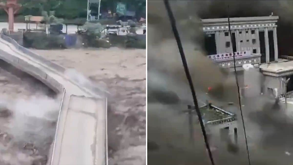
A high-velocity mass wasting event along the Nepal-Tibet border triggered a catastrophic transboundary flash flood, invalidating standard assumptions of mountain corridor stability. The disaster, centered around the Rasuwa district and Tibet's Gyirong county, demonstrated the destructive potential of unmeasured kinetic energy release in steep alpine gradients. Rather than a simple meteorological anomaly, the event exposed systemic vulnerabilities in regional infrastructure design, early-warning telemetry, and cross-border hydrological monitoring.
The Mechanics of Alpine Mass Wasting
The sequence began with a massive slope failure near the high-altitude glacial zones, which initial seismic monitoring mistook for tectonic activity. Long-period seismic wave analysis later confirmed the energy signature originated from a catastrophic landslide and localized glacier destabilization. This sudden displacement of rock, ice, and debris crashed into narrow river gorges, creating an unstable natural dam across the upper reaches of the drainage basin.
When this temporary barrier failed under hydrostatic pressure, it released a concentrated hydraulic pulse down the Bhote Koshi and Trishuli river corridors. The physical force of water mixed with high-density sediment behaves less like a standard river flow and more like a moving wall of slurry. This dense slurry increases the specific gravity of the flood wave, multiplying its shear stress on structural foundations. Bridges, reinforced concrete buildings, and hydropower installations encountered impact loads that far exceeded standard 100-year flood specifications.
Infrastructure Vulnerability and the Cost Function of Geography
Himalayan cross-border trade routes and energy projects occupy extremely constrained topographies. Valleys are V-shaped, forcing roads, border posts, and settlements onto narrow alluvial fans directly adjacent to high-energy river beds. This spatial compression creates an unforgiving economic and structural cost function:
- Proximity Penalty: Locating transport arteries and custom facilities valley-bottoms minimizes initial engineering grading costs but maximizes exposure to hydraulic hazards.
- Asset Concentration: Hydropower run-of-river plants require direct riverbed access, placing generating equipment and intake tunnels precisely where sediment-laden flash floods concentrate.
- The Single-Point-of-Failure Network: Transnational transit depends on critical links like the Rasuwagadhi Friendship Bridge. When high-density debris flows target these fixed choke points, entire regional supply chains and pilgrimage paths fracture instantaneously.
The destruction of newly rebuilt infrastructure underscores a persistent miscalculation in civil engineering parameters across High Asia. Structures designed to withstand high water volume often fail because they are tested against solid-load impacts—millions of tons of moving boulders and glacial silt moving at highway speeds.
Transboundary Telemetry and the Information Vacuum
The speed of the disaster exposed critical gaps in early warning operational protocols. Flash floods originating in high-altitude Tibetan catchments crossed international boundaries into densely populated Nepalese valleys within minutes. Without automated, real-time sensor arrays measuring upstream hydrostatic spikes and sub-surface ground movement, downstream communities received no quantitative warning.
Visual observation and security camera feeds captured the terminal phase of the wave, but visual confirmation offers zero latency for evacuation. Effective risk mitigation requires automated telemetry loops that decouple warning systems from human visual verification. When communication lines and power grids are severed in the initial second of impact, centralized emergency response becomes blind, forcing rescue operations into a reactive, high-risk posture where aerial assets remain grounded due to low visibility and turbulent debris fields.
Regional Cascades and Downstream Propagation
As the hydraulic shockwave transitioned from steep mountain gradients into broader alluvial plains in downstream regions, the threat profile shifted from direct kinetic destruction to widespread inundation. Authorities in northern Indian states, including Bihar and Uttar Pradesh, faced the downstream arrival of swollen river systems, necessitating emergency evacuations of thousands of residents. This demonstrates that high-altitude mass-wasting events are not localized incidents; they function as macro-regional hydraulic pulses that threaten multiple administrative jurisdictions sequentially.
The human toll, highlighted by hundreds of missing tourists and residents, points to the failure of seasonal risk communication frameworks. Standard monsoon advisories fail to capture the stochastic nature of slope collapses and glacial lake outbursts, which occur independently of ongoing rainfall totals.
Deploy structural engineering interventions that abandon the practice of rebuilding fixed assets in high-risk valley floors. Transition regional transit and energy planning toward subterranean tunneling, high-span suspension architecture that clears maximum flood heights, and automated acoustic-sensor tripwires positioned twenty kilometers upstream to buy critical evacuation seconds for vulnerable settlements.