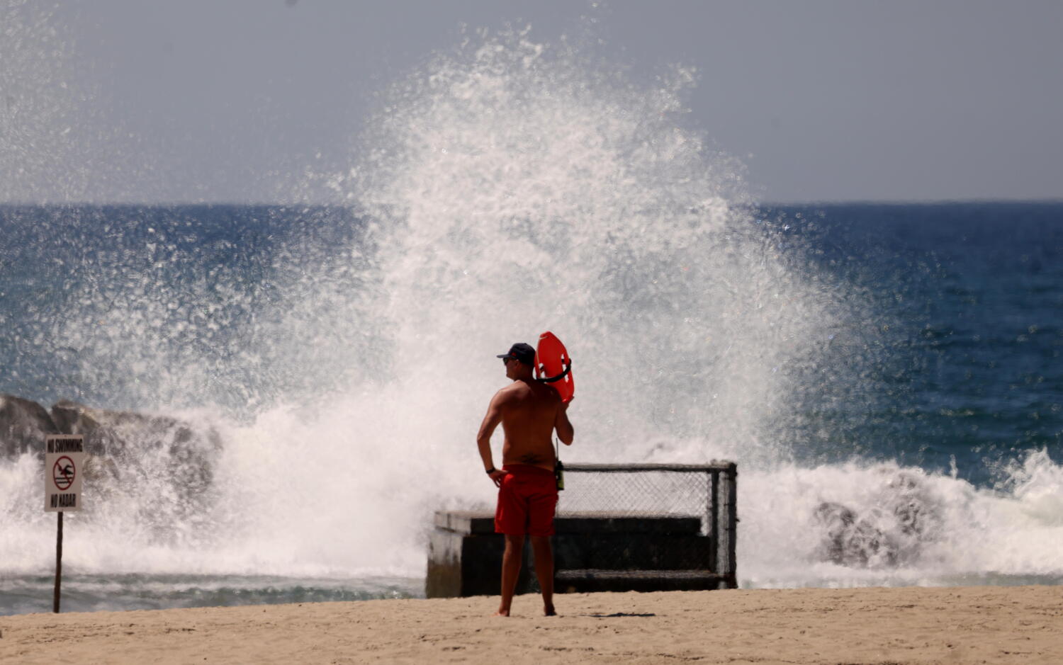
Coastal storm risk in Southern California is routinely miscalculated through a binary lens of direct landfall. When a tropical system tracks northward off the Baja California Peninsula, public attention anchors exclusively on whether the center crosses the coastline. This singular metric creates a severe analytical blind spot. The physical mechanics of tropical cyclones dictate that destructive impacts—ranging from extreme rip currents and structural coastal erosion to catastrophic inland flash flooding—occur hundreds of miles away from the eye of the storm.
Predicting the footprint of a Pacific tropical system requires separating marine hazards from atmospheric precipitation dynamics. While cooler ocean temperatures along the California current typically force these storms to undergo rapid extratropical transition, weakening their wind fields, the residual moisture plumes and long-period swells retain substantial destructive capacity. Evaluating regional vulnerability necessitates analyzing three distinct operational vectors: hydrodynamic ocean swell energy, atmospheric river precipitation efficiency, and local orographic enhancement.
Hydrodynamic Ocean Swell Mechanics
The primary hazard generated by distant tropical cyclones manifests along the coastline long before any atmospheric changes occur onshore. As a system churns over warm tropical waters, it transfers monumental kinetic energy to the ocean surface, generating long-period swells that propagate outward across thousands of miles of open ocean with minimal energy loss.
When these long-period waves encounter the abrupt shallowing of the Southern California continental shelf, their wave height increases dramatically due to shoaling processes. Unlike wind chop, which is chaotic and short-period, tropical swells arrive in organized sets with periods exceeding sixteen to twenty seconds. This high-energy wave regime produces several compounding coastal vulnerabilities:
- Massive Setup and Runup: Sustained wave action elevates the local sea level above the predicted astronomical tide, a phenomenon known as wave setup. When combined with high astronomical tides, this forces water across engineered seawalls and low-lying coastal access routes.
- Extreme Rip Current Generation: The sheer volume of water pushed shoreward must escape back out to sea, carving intense, unpredictable rip channels that bypass standard lifeguard safety perimeters and threaten piers, harbors, and beachgoers.
- Accelerated Beach Erosion: High-frequency, high-energy impact scours sand from the upper beach profile and deposits it into offshore bars, stripping natural protective buffers from coastal infrastructure.
Atmospheric River Precipitation Efficiency
The inland risk profile is governed by thermodynamics rather than wave mechanics. When a weakening tropical cyclone interacts with mid-latitude troughs, it often injects massive quantities of tropical moisture into the prevailing westerly flow, establishing an atmospheric river. The destructive potential of this precipitation is not measured by total rainfall accumulation alone, but by precipitation efficiency and hourly rainfall rates.
Southern California features a complex topography characterized by narrow coastal plains abutting steep mountain ranges. When moisture-laden air masses encounter these coastal mountain barriers, orographic lift forces the air to rise rapidly. As the air ascends, it cools adiabatically, condensing water vapor into intense rainfall at rates that frequently exceed the infiltration capacity of local soils.
This dynamic triggers two primary cascading hazards:
- Burn Scar Debris Flows: Areas previously affected by wildfires lose their vegetative canopy and develop water-repellent soil layers. When intense hourly rainfall rates hit these slopes, the topsoil liquefies into high-density debris flows capable of moving boulders, vehicles, and structures with unstoppable momentum.
- Urban Flash Flooding: Highly urbanized watersheds feature extensive impermeable surfaces such as asphalt, concrete, and engineered channelization. These surfaces prevent natural percolation, rapidly routing runoff into concrete-lined flood control channels that can quickly reach capacity and overflow into adjacent neighborhoods.
Emergency Management and Regional Preparedness
Mitigating the risks posed by systems that threaten Southern California without making direct landfall requires a fundamental shift in emergency response posture. Traditional warning systems tied to wind speed categories fail to capture the multi-faceted nature of marine and hydrological threats. Resource allocation must instead pivot toward predictive modeling of wave energy indices and soil saturation thresholds.
Civilians and municipal planners must decouple the concept of danger from wind speed metrics. A storm downgrade from hurricane to tropical storm status does not signal an all-clear condition for coastal navigation, harbor security, or hillside stability. Infrastructure resilience depends on maintaining clear drainage systems, enforcing strict coastal building setbacks to account for wave runup, and executing timely evacuations for burn scar zones well in advance of peak precipitation rates.
Monitor continuous marine forecasts issued by the National Weather Service specific to long-period swell arrivals, and track local soil moisture sensors rather than waiting for visual confirmation of heavy rainfall before executing localized flood mitigation protocols.