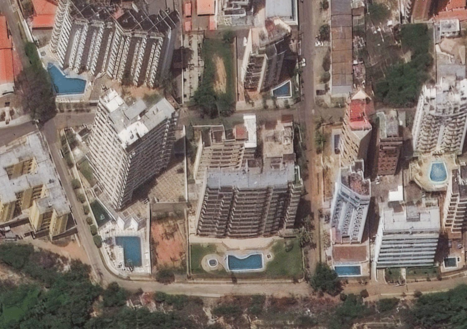
From five hundred miles above the Earth, a disaster looks remarkably like geometry.
When the first earthquake struck the northern coast of Venezuela, followed hours later by a second, equally violent tremor, satellite arrays orbiting in the silent chill of space began their automated routines. They swiveled. They clicked. They transmitted gigabytes of raw data down to receiving stations across the globe. On a monitor in a well-lit office half a world away, the unfolding tragedy did not look like screaming, or dust, or the desperate scraping of fingernails against rubble. It looked like a sudden disruption in a series of neat, gray lines.
Where a straight line once ran—indicating a coastal highway that connected isolated fishing villages to major medical hubs—there was now a jagged break. Where a dense cluster of perfect rectangles stood, representing the metal roofs of a working-class barrio in Sucre, there was only a blurred, asymmetric smudge.
Satellites specialize in the macro view. They provide a detached, bird's-eye perspective that allows organizations to quantify ruin. They can tell you that tens of thousands of structures have suffered catastrophic failure. They can map the precise millimeter shift of a tectonic fault line running along the Caribbean plate. But the true danger of relying entirely on the view from orbit is that it flattens the world. It turns human suffering into a cartographic puzzle.
To understand what those gray lines actually mean, you have to go down to the dirt.
Consider a hypothetical family living on the outskirts of Carúpano. Let us call the father Mateo. Before the ground shook, Mateo's world was defined by the immediate and the tangible. The smell of frying plantains, the rhythmic thump of the surf against his fishing boat, and the constant, low-level anxiety of navigating an economy already stretched to its absolute breaking point. When the earth buckled, his house did not just collapse. It disintegrated.
The concrete block construction common to the region lacks the internal skeletal support of steel rebar. It is cheap, it is accessible, and in a seismic zone, it is a trap. In a matter of twelve seconds, Mateo's life was reduced to what he could salvage with his bare hands. The satellite image captures the roof of his home shifting three meters to the left. It does not capture the sound of him calling out for his neighbor through a cloud of pulverized mortar.
This is the invisible stake of the disaster. The double earthquake did not just break buildings; it shattered an already fragile infrastructure that was keeping millions of people barely afloat.
When a catastrophe hits a nation with a robust, well-funded infrastructure, the recovery begins almost immediately. Utilities are restored, emergency services deploy from functional staging areas, and supply chains pivot. But along the Venezuelan coast, the earthquakes hit an environment where the systems were already frayed. Water treatment plants were already operating at a fraction of their capacity. The electrical grid was a patchwork of temporary fixes.
Now, look back at the satellite data with that context.
When a thermal imaging satellite shows a massive blackout across an entire state, it is not just showing a lack of light. It is showing the precise moment that the milk spoiled in the few remaining functional grocery stores. It is showing a hospital where the backup generators are failing, forcing doctors to ventilate premature infants by hand. It is showing the total evaporation of the digital communication network, leaving families in the capital agonizing over whether their relatives on the coast are dead or alive.
The technology we use to observe these events has evolved at a dizzying pace. We can now view the planet in resolutions so sharp that you can count the cars trapped in a landslide. Optical sensors pierce through cloud cover using synthetic aperture radar, bouncing microwave signals off the terrain to create three-dimensional models of the destruction in pitch darkness.
Yet, there is a profound vulnerability in this technological mastery. We risk becoming voyeurs of statistics. It is easy to look at a color-coded map where red denotes "heavy damage" and yellow denotes "moderate damage" and feel as though we have grasped the situation. We haven't. The color red cannot communicate the specific, piercing panic of a mother looking for clean water in a town where every pipe has been severed and the local river is choked with debris.
The data tells us the what. It can never tell us the why, or the how much it hurts.
The real story of the dual Venezuelan earthquakes is found in the friction between the macro and the micro. It is found in the fact that while international agencies use orbital imagery to debate logistics and funding allocations in sterile conference rooms, people on the ground are using broken pieces of timber to dig through the remnants of their lives.
As the days press on, the satellites will continue their quiet, orbital paths. They will take new images showing the slow clearance of the roads. The jagged lines will gradually straighten out. the smudges will be replaced by the clear, sharp squares of temporary tents and aid stations. From space, it will look like progress. It will look like healing.
But on the ground, the dust takes a very long time to settle, and the earth retains a memory of the shaking long after the sensors have stopped recording the data. Mateo will stand on the patch of earth where his front door used to be, looking out at a sea that remains stubbornly, indifferently blue.