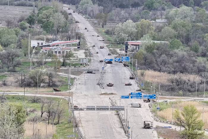
Civilians fleeing a Russian-held city along mined roads are not simply facing random danger; they are navigating a high-friction decision environment governed by asymmetric force protection, deteriorating infrastructure, and stark survival trade-offs. Standard human-interest reporting on contested evacuations often treats flight as a single binary choice—stay or leave—and frames road hazards as isolated misfortunes. A rigorous analytical breakdown instead treats civilian movement out of a contested or occupied municipality as a coupled risk-and-logistics problem. This article maps the structural mechanics of mined egress routes, separates established operational realities from analytical hypotheses, examines why civilians accept severe physical risk, and outlines where humanitarian corridors fail and what operational adjustments matter most.
Deconstructing Standard Evacuation Reporting
Conventional reporting on civilians escaping occupied or besieged settlements relies heavily on immediate emotional contrast: ruined buildings, checkpoints, fear of explosives, and the relief of reaching friendly lines. Those details capture the human stakes, yet they frequently obscure the causal chain that turns a standard highway or rural track into a lethal bottleneck.
A typical narrative of desperate flight along mined roads compresses several distinct processes into one picture:
- Spatial compression: A road network that once distributed traffic across dozens of arteries shrinks to one or two passable or semi-passable routes due to damaged bridges, destroyed culverts, cratered asphalt, or defensive fortifications.
- Hazard uncertainty: Landmines and unexploded ordnance create probabilistic risk rather than uniform danger. A stretch of pavement may remain quiet for dozens of passages before a single vehicle or footfall triggers a device.
- Information asymmetry: Civilians inside a Russian-held city rarely possess real-time intelligence on where defensive belts have been laid, cleared, or shifted, or how checkpoints are behaving hour by hour.
- Compounding stressors: Physical danger interacts with shortages of electricity, clean water, heating fuel, medical care, and cash. People rarely weigh mine risk in a vacuum; they weigh it against slow attrition if they remain in place.
When reporting stops at "desperate civilians risk their lives," it describes an outcome without explaining the system that produced it. From an analytical standpoint, the core question is how an occupying or defending force shapes movement space, how households evaluate survival probabilities under severe uncertainty, and what constrains safe passage.
The Cost Function of Contested Flight
Every household trapped in an occupied or frontline city faces an informal, high-stakes cost function. Rather than calculating exact percentages, residents weigh competing losses across time:
- Immediate kinetic cost: The risk of death or severe injury from anti-personnel mines, anti-vehicle mines, tripwires, scatterable munitions, artillery, or small-arms fire along the route.
- Attrition cost of staying: The cumulative toll of power outages, unheated apartments in cold weather, contaminated water, untreated chronic illness, lack of food variety, and exposure to shelling or urban combat.
- Economic and asset cost: Abandoning housing, vehicles, tools, savings, and local livelihood networks, often with little assurance of stable income or housing upon arrival elsewhere.
- Control and coercion cost: Exposure to filtration or security screenings, document checks, detention risk, restrictions on communication, or pressure to accept specific travel directions.
Movement occurs when the perceived cumulative cost of remaining crosses a household's threshold relative to the perceived cost of departure—or when an acute shock, such as renewed shelling or the loss of basic utilities, abruptly spikes the cost of staying.
Known Facts Versus Educated Hypotheses
Rigorous analysis requires separating verified operational mechanics from educated hypotheses when exact local figures are unavailable.
Known facts about modern mechanized warfare and mined egress routes include:
- Mines serve defensive and area-denial functions: Militaries emplaced anti-tank and anti-personnel mines along approaches, flanks, intersections, and chokepoints to channel movement, slow advances, impose casualties, and force expensive breaching operations.
- Unmarked or poorly mapped hazards multiply civilian risk: Even when formal minefields are recorded by the laying unit, improvised placements, shifting front lines, weather erosion, washed-out shoulders, and unexploded ordnance leave civilians without reliable visual cues.
- Route choice shifts risk profiles: Paved main roads are often monitored, fortified, or targeted by heavy ordnance, whereas unpaved bypasses, field tracks, and tree lines may lack cleared lanes or contain hidden devices placed to deter flanking movement.
Educated hypotheses—plausible analytical inferences where granular data is incomplete—include:
- Selective enforcement at checkpoints: Where an occupying force controls exit points, passage likely fluctuates between strict filtering, arbitrary delays, and periods of relative permissiveness depending on local command priorities and security concerns.
- Information cascades among evacuees: When a small group completes a route without incident, others are more likely to attempt the same corridor, even if a single successful crossing does not prove the road is clear.
- Seasonal degradation of alternative tracks: Rain, mud, snow, and freeze-thaw cycles likely push travelers off soft shoulders and rural detours back onto harder roadbeds, concentrating traffic where hazards may be more prevalent or more visible.
Treating educated hypotheses as settled fact distorts strategic judgment. Labeling them clearly preserves analytical honesty while still allowing planners to model contingencies.
Mechanics of Minefields and Chokepoints
To understand why a road becomes perilous for fleeing residents, it helps to examine how physical terrain and military engineering interact. Roads are linear constraints. In contested areas, damaged overpasses, felled trees, craters, and river crossings funnel vehicles and pedestrians into narrow corridors.
From a military engineering perspective, mines are designed to impose friction—consuming time, disrupting tempo, creating psychological strain, and inflicting physical damage without requiring continuous manned fire at every point. Anti-vehicle mines are generally engineered to require heavy downward pressure to detonate, while anti-personnel mines or tripwires can be triggered by lighter loads or disturbance. In practice, however, damaged fuzes, shifting soil, debris, or unintended interactions can make any ordnance unpredictable.
Civilians traveling on foot, by bicycle, or in passenger cars encounter hazards differently than armored columns:
- Visibility limits: Dust, fog, low light, tall grass, rubble, and snow conceal surface indicators, tripwires, and displaced soil.
- Shoulder forcing: Potholes, craters, or stalled vehicles push drivers onto verges and embankments where mines or unexploded submunitions frequently rest.
- Evacuation bottlenecks: When multiple vehicles or groups converge on a single narrow stretch, stopping to inspect the road or assist an injured traveler increases exposure time to indirect fire or observation.
Clearing a mined corridor safely requires specialized equipment, trained personnel, time, and security—conditions rarely met during active hostilities along an unverified civilian escape route.
Why Civilians Accept Extreme Risk
Observing people move toward or along dangerous roads can seem counterintuitive until their alternatives are examined. Risk tolerance in a crisis is shaped by comparison, not comfort.
When essential services fail—water supply stops, hospitals run low on supplies or staff, heating disappears, or combat draws closer—staying ceases to feel safe. A known or suspected danger on the road begins to compete against a steady, grinding deterioration at home. Families with children, older relatives, or people needing medical care often conclude that taking a finite gamble on transit is preferable to remaining trapped as conditions worsen.
Social networks also influence timing. Neighbors share word of who made it through, which turn appeared passable, or which checkpoint was closed. Yet word-of-mouth intelligence has sharp limits: conditions can change within hours due to new engineering work, shelling, or shifting command orders.
Operational Realities and Limits of Mitigation
Anyone evaluating civilian evacuation from a contested city must confront a sobering operational truth: there is no risk-free method for civilians to traverse an active, mined conflict zone without formal, negotiated, and verified safe passage. Even then, ceasefires and corridors have historically proved fragile.
When humanitarian agencies, local authorities, or outside observers assess these situations, practical measures focus on harm reduction rather than complete elimination of risk:
- Consolidate verified route intelligence: Cross-check reports from multiple independent sources, satellite imagery where available, and mine-action advisories to distinguish confirmed hazards from rumors.
- Communicate clear hazard behaviors: Emphasize staying on established, observed surfaces where feasible rather than cutting across fields or verges, avoiding touching unfamiliar metal or wire objects, and maintaining spacing between vehicles or walkers.
- Prepare trauma and transit support: Position medical stabilization, water, shelter, and transport staging points as close to safe exit zones as security allows so those who get through can recover and move onward quickly.
- Document incidents systematically: Record locations, munitions types when safely identifiable, and casualty patterns to support future demining priorities and accountability efforts.
Every one of these measures faces steep constraints. Real-time verification inside an active war zone is difficult; advice cannot override physical blockages or sudden shelling; and humanitarian access depends on security conditions and belligerent behavior that external actors cannot fully control.
Strategic Recommendation for Analysts and Responders
Analysts, policymakers, and humanitarian planners covering or supporting evacuations from Russian-held cities should shift their operational focus from reactive crisis snapshots to corridor-level risk mapping paired with rapid reception readiness. Instead of treating civilian departures as a single headline event, teams should track three linked indicators continuously: utility and service degradation inside the city, physical chokepoints and reported mine or ordnance incidents along exit axes, and reception capacity at onward transit hubs. Pairing disciplined verification of route hazards with well-stocked, rapid-intake reception points downstream delivers higher practical value than broad appeals or unverified route tips—because once civilians commit to leaving a contested city, reducing friction and delay after they clear the danger zone is one of the few variables responders can reliably control.


